Category of Astronomical Heritage: tangible immovable
Seven-stone Antas, Portugal/Spain (multiple locations): General description
Multiple descriptions from different sources
There are multiple descriptions from different sources of information for this entity
 ICOMOS - IAU case study
 IAU extended case study
Presentation
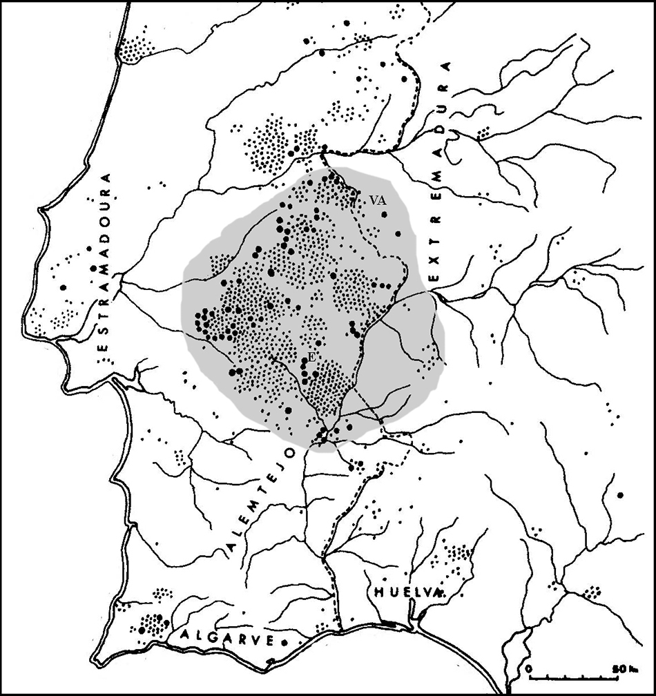
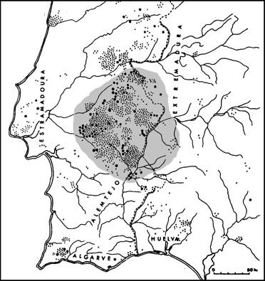
Geographical position
177 locations in the central Alentejo region, Portugal, and the provinces of Badajoz and Cáceres, Extremadura region, Spain:
- General description for all locations
- Coutada, Elvas
- Huerta de las Monjas
- Lanchas I
- Gonçala 2, Mora
- Remendo 1, Mora
- Pero d’Alba, Castelo de Vide
- Datas I
- Sobral, Castelo de Vide
- Coureleiros 3, Castelo de Vide
- Caeira 3, Mora
- Tapada del Anta I
- Herdade do Duque, Reguengos
- Patalim, Évora
- Coureleiros 2, Castelo de Vide
- Torrão 1, Elvas
- Coureleiros 4, Castelo de Vide
- Caeira 4, Mora
- Cré 1, Mora
- La Morera
- Olival do Monte Velho, Elvas
- Silval, Évora
- Coureleiros 1, Castelo de Vide
- Paredes, Évora
- Defesinhas 1, Elvas
- Cré 2, Mora
- Bota 1, Évora
- Currais do Galhordas, Castelo de Vide
- Zafra II
- Tapias II
- Claros Montes 1, Arraiolos
- Caeira 1, Mora
- La Barca
- Pinheiro do Campo 1, Évora
- Huerta Nueva
- (La) Miera
- Freixo de Cima {1}, Évora
- San Diniz, Mora
- Gonçala 6, Mora
- Figueirinha 2, Mora
- Portela, Mora
- Farisou 4, Reguengos
- Cabeção, Mora
- Entreáguas, Estremoz
- Aldeia da Mata, Crato
- S. Lourenço 1, Crato
- Tapadões, Crato
- Pombal, Castelo de Vide
- Torre das Águias 1, Mora
- Herdade da Anta, Évora
- Cré 3, Mora
- Zafra III
- Monte dos Frades, Elvas
- Aguiar, Évora
- Torre das Águias 2, Mora
- Adua 1, Mora
- Caeira 2, Mora
- Sauza 4, Évora
- Serrinha, Crato
- Vale d’Anta, Redondo
- Zafra IV
- Claros Montes 2, Arraiolos
- Cebolinhos 3, Reguengos
- Gonçala 1, Mora
- Bota 2, Évora
- Colmeeiro, Redondo
- Cabeças, Évora
- Vale Carneiro 1, Reguengos
- Sardinha, Elvas
- Sauza 3, Évora
- Paço 1, Redondo
- Olheiros, Castelo de Vide
- Zambujalinho, Évora
- Lanchas II
- Gonçala 4, Mora
- Vale de Moura 1, Évora
- Cajirón I
- Silveira, Redondo
- Paço das Vinhas, Évora
- Horta do Zambujeiro, Redondo
- Monte Ruivo, Elvas
- Gáfete 1, Crato
- Cajirón II
- Zafra I
- Anta Grande dos Antões, Mora
- Cebolinho 2, Reguengos
- Pão Mole, Alandroal
- Candeeira, Redondo
- Torre das Arcas 1, Elvas
- Anta de la Marquesa
- Gáfete 2, Crato
- Casas do Canal, Estremoz
- Farisoa 1, Reguengos
- Azaruja 2, Évora
- Azaruja 1, Évora
- Gorginos 3, Reguengos
- Barrosinha 1, Évora
- Olival da Pega 2, Reguengos
- Bernardo, Ponde de Sor
- Anta do Crato, Crato
- Anta Grande do Zambujeiro, Évora
- Monte Novo 2, Reguengos
- Anta Grande, Olival da Pega, Reguengos
- Freixo de Cima 2, Évora
- São Gens, Nisa
- Farisoa 5, Reguengos
- Dom Miguel, Elvas
- Fragoso
- São Rafael 1, Elvas
- Farisoa 2, Reguengos
- Matanga, Ponte de Sor
- Sauza 1, Évora
- Monte das Oliveiras, Mora
- Pau, Évora
- Santa Luzia, Alandroal
- Datas II
- Briços, Mora
- Cebolinhos 1, Reguengos
- Vidigueiras 2, Reguengos
- Galvães, Alandroal
- Sauza 2, Évora
- Gonçala 3, Mora
- Defesinhas 2, Elvas
- Sobral, Elvas
- Pombal 5, Elvas
- Azinheiras, Évora
- Paço 1, Reguengos
- Pena Clara 1, Elvas
- Tapias I
- Lapeira, Mora
- Gonçala 5, Mora
- Vale de Rodrigo 3, Évora
- Forte das Botas, Elvas
- Conto do Zé Godinho, Castelo de Vide
- Quinta das Longas, Elvas
- Monte dos Negros, Elvas
- Vale de Moura 2, Évora
- Vale de Rodrigo 2, Évora
- Hospital, Redondo
- Farisoa 7, Reguengos
- Gorginos 1, Reguengos
- São Rafael 2, Elvas
- Corchero
- Corticeira, Estremoz
- Vidigueiras, Redondo
- Casas Novas, Redondo
- Torre das Arcas 2, Elvas
- Valmor, Elvas
- Vidigueiras 1, Reguengos
- Melriça, Castelo de Vide
- Barrosinha 2, Évora
- Avessadas, Elvas
- Pinheiro do Campo 2, Évora
- Monte Novo 1, Reguengos
- Monte Novo 4, Reguengos
- Vale Carneiro 5, Reguengos
- Paço 2, Redondo
Location
Latitudes vary from 37.8° to 39.6° N, longitudes from 8.2° to 7.0° W, and elevations from c. 200m to 580m above mean sea level.
General description
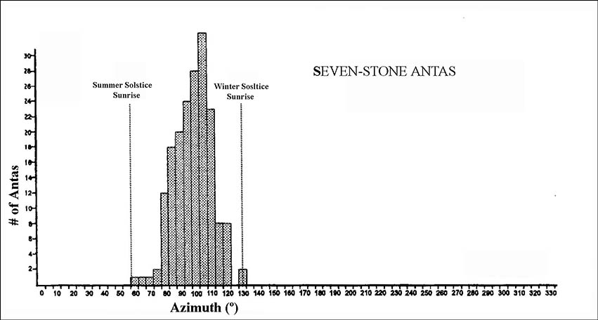
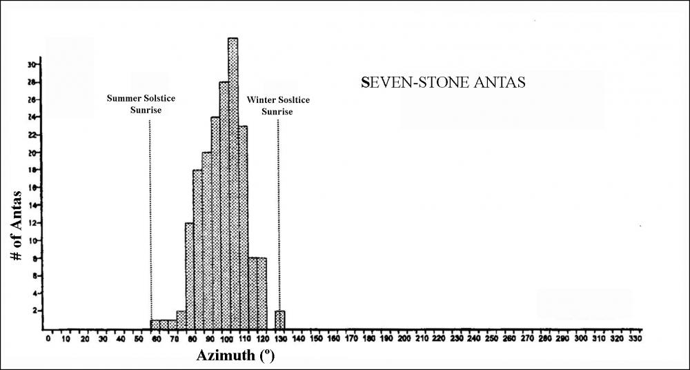
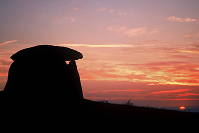
The seven-stone antas are a distinctive form of megalithic tomb. The 177 examples whose principal orientation can be reliably determined all, without exception, face within the arc of sunrise (the part of the horizon where the sun rises at some time during the year).
Brief inventory
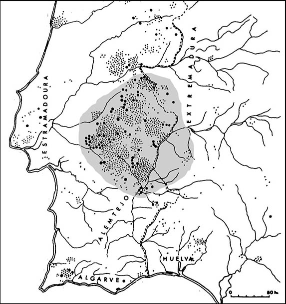
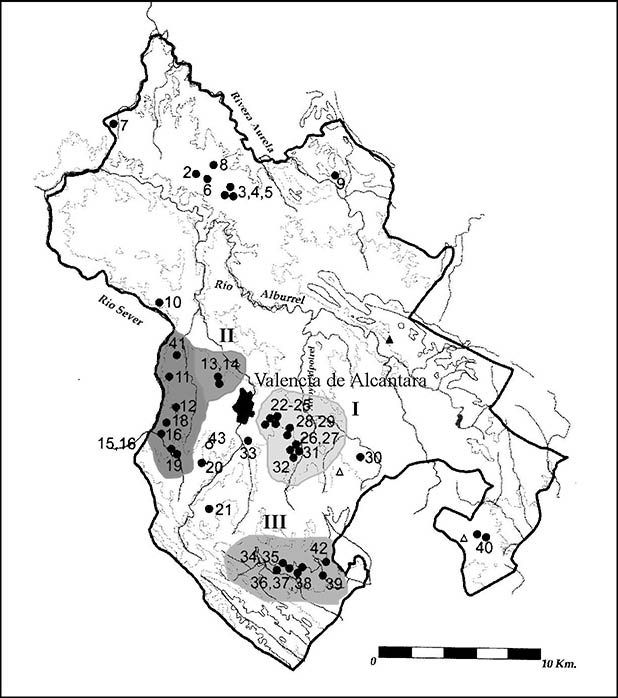
Seven-stone antas are distributed over an area approximately 100km east to west, from about 50km from the coast near Lisbon to the Spanish border provinces, and a little over 200km from south to north, from Ourique to the River Tejo. The main concentrations of sites within the group are around the towns of Évora and Elvas (Portugal) and Valencia de Alcántara (Spain).
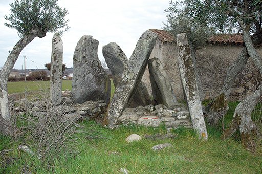
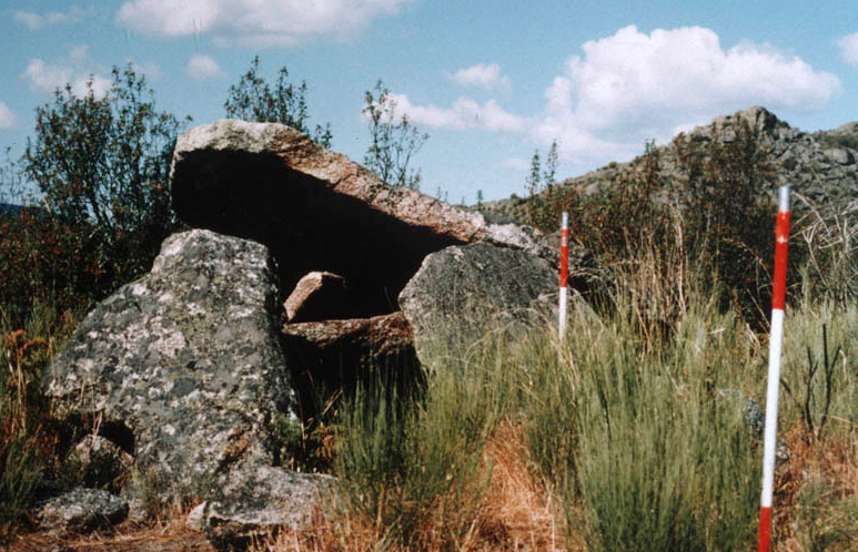
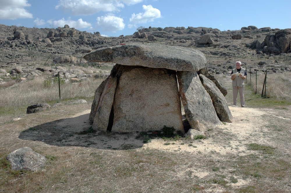
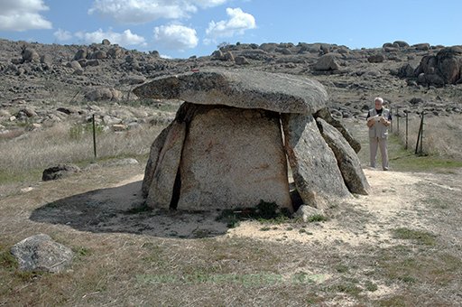
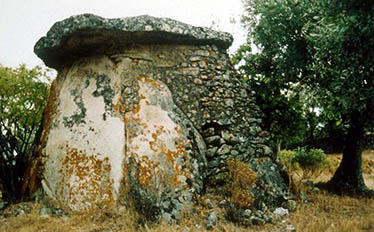
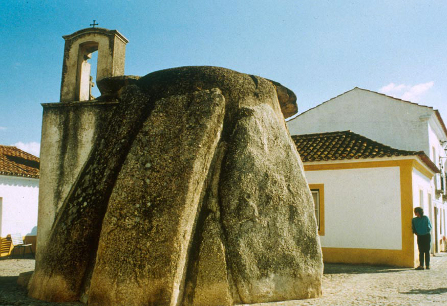
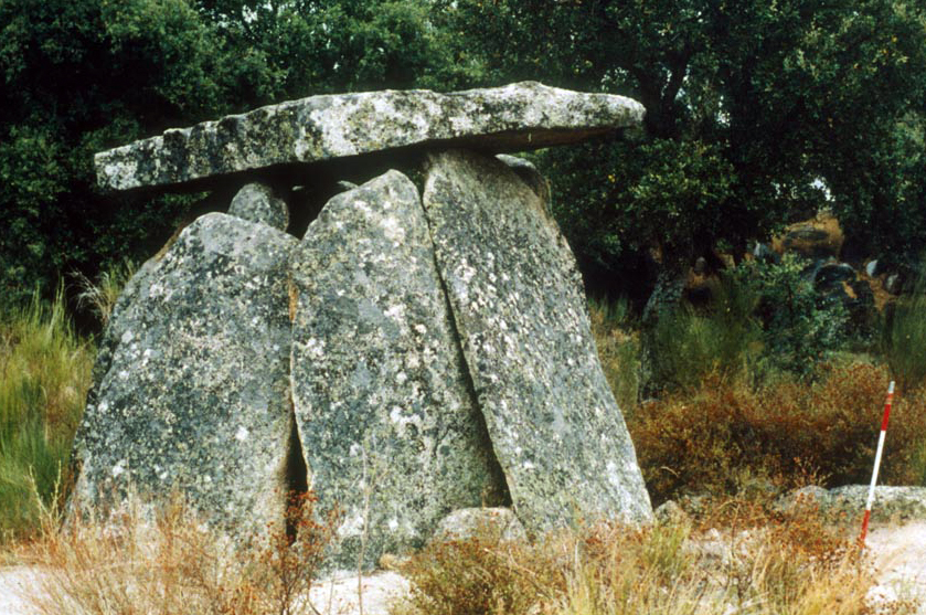
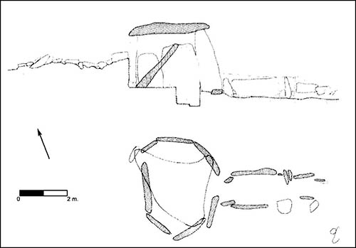
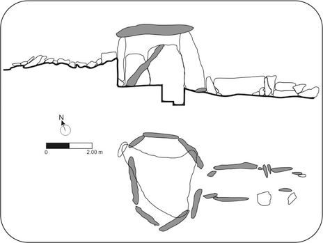
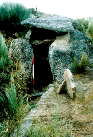
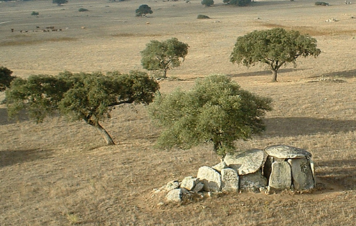
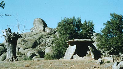
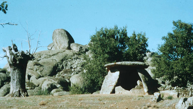
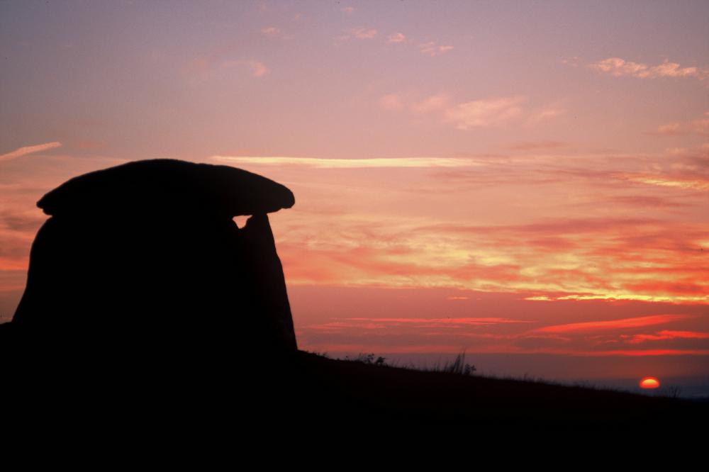
The seven-stone antas (dolmens) were mostly constructed using tall blocks of granite, typically 3m or more in height. In some areas the builders used smaller blocks of schist. Seven-stone antas are distinguished from other megalithic tombs found in the same region by the presence of a passage and by their distinctive method of construction. This involved erecting a backstone and then leaning three uprights in succession on each side so as to form a chamber typically some 4m to 5m in diameter with a clearly defined entrance to which a short passage of smaller orthostats was attached.
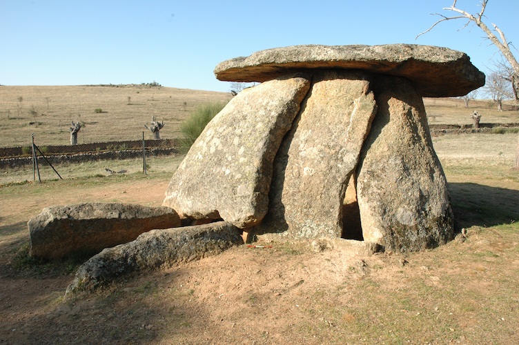
Fig. 1: The seven-stone anta at Mellizo, near Valencia de Alcántara, Spain. Photograph © Clive Ruggles
History
These tombs are thought to have been constructed from c. 4000 BC onwards, with longer corridors appearing around 3200 BC.
Cultural and symbolic dimension
The range of orientations of the 177 monuments corresponds almost exactly to the range of possible rising positions of the sun. In other words, each tomb in the group without exception is oriented within the arc of sunrise, corresponding to about one sixth of the available horizon. In almost cases the orientations fall between azimuths of 61° (29° north of east) and 122° (32° south of east); there are two exceptions, which are oriented more towards the south (azimuth 128°-129°), but these are within a deep valley with a higher eastern horizon, and so still face sunrise. This remarkable statistic provides the strongest possible indication of an association between these tombs and the sun.
If the tombs were oriented to face sunrise on the day when construction began, then the distribution of azimuths would suggest that this took place predominantly in the spring or autumn, but the fact that orientations span the entire solar rising range implies that in some cases construction was commenced in the middle of summer or winter. The ‘exactness of fit’ between the range of tomb orientations and the arc of sunrise suggests that the tombs were aligned with a precision of about 1-2 degrees (2-4 solar diameters).
Comparative analysis
No information supplied.
Authenticity and integrity
A number of the examples near Valencia de Alcántara (e.g. Cajirón I, and Zafra I and II) have been reconstructed. In some cases these reconstructions raise serious authenticity issues regarding the orientation.
Documentation and archives
No information supplied.
Management and use
Present use
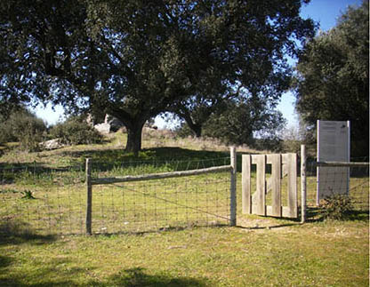
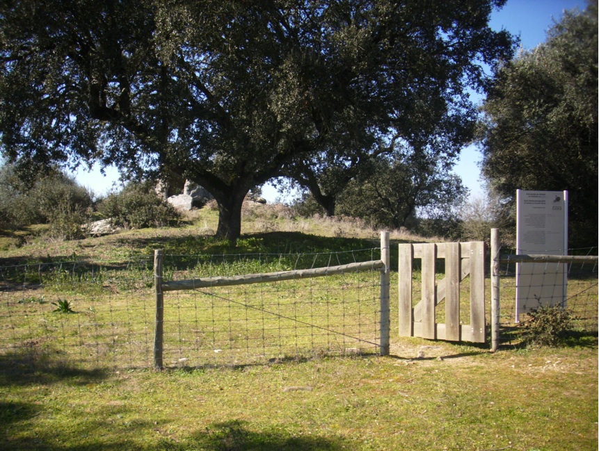
Most of the sites are on privately owned farmland and only accessible to the public with the landowner’s permission.
State of conservation
The sites are in various states of repair. Some of the Spanish examples, such as Cajirón I, have been reconstructed since their orientations were determined in the 1990s.
Main threats or potential threats
A set of small, isolated monuments in a variety of land-use situations face various potential threats, but are generally safe from the damage that might be caused by large numbers of visitors. An additional danger specific to the astronomical significance of these sites is reconstructions such as those mentioned above. If these disturb the orientation, then they could lead to misunderstandings about the individual and collective significance of these monuments.
Protection
In Portugal, archaeological sites are protected by the Ministério da Cultura under Heritage Law no. 107/2001. In Spain, they are protected under Articles 14–25 of Law 16/1985 on Spanish Historical Heritage.
Context and environment
No information supplied.
Archaeological / historical / heritage research
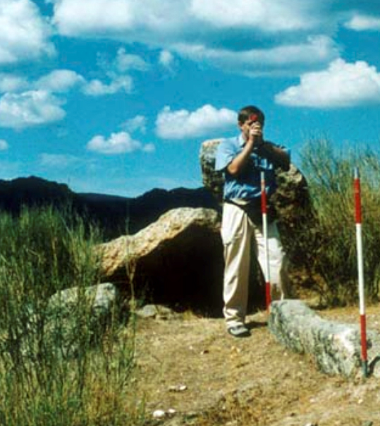
Some of the tombs in both countries have been excavated. The orientations of the seven-stone antas were first systematically measured by Michael Hoskin between 1994 and 1998, as part of a 12-year fieldwork campaign measuring the orientations of many hundreds of tombs and temples in the western Mediterranean.
Management, interpretation and outreach
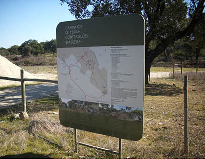
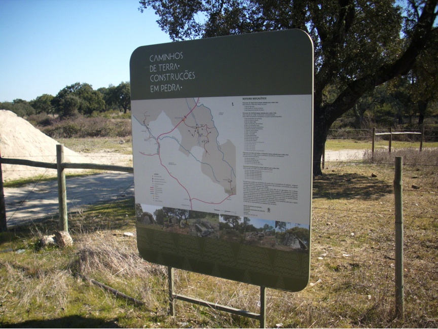
Most of the tombs are on privately owned farmland. Some local authorities, such as those at Évora, Castelo de Vide, Valencia de Alcántara and Cedillo, have produced booklets or pamphlets for tourists with information about the nature and whereabouts of some of the sites in their area.
References
Bibliography (books and published articles)
- Belmonte, J.A. and Belmonte J.R. (2002). Astronomía y cultura en el megalitismo tempranote la Península ibérica: los dólmenes de Valencia de Alcántara, in Arqueoastronomía hispana, edited by J.A. Belmonte. Madrid: Equipo Sirius, 99-112.
- Belmonte, J.A. and Hoskin, M. (2002) Reflejo del cosmos: atlas de arqueoastronomía del Mediterráneo occidental. Madrid: Equipo Sirius.
- Calado, M. (2004). Menires do Alentejo Central. Génese e evoluçáúo da paisagem megalítica regional. Lisboa: Universidade de Lisboa [Ph.D thesis].
- Cardoso, J.L. (2002). Pré-História de Portugal. Lisboa: Editorial Verbo.
- González García, A.C. and Belmonte, J.A. (2010). Statistical Analysis of Megalithic Tomb Orientations in the Iberian Peninsula and Neighbouring Regions. Journal for the History of Astronomy 41, 225-38.
- Bejarano, F. (1992). Guía del conjunto megalítico de Valencia de Alcántara.Valencia de Alcántara: Ayuntamiento de Valencia de Alcántara.
- Bueno Ramírez, P. (1988). Los Dólmenes de Valencia de Alcántara. Madrid: Subdirección General de Bellas Artes y Arqueología.
- Bueno Ramírez, P. and Vázquez Cuesta, A. (2008). Patrimonio arqueológico de Valencia de Alcantara. Estado de la cuestión. Valencia de Alcántara: Ayuntamiento de Valencia de Alcántara.
- Gomes, C.J., Sarantopoulos, P., Gomes, M. V., Calado, M., de Oliveira, J., Mascarenhas, J.M., Barata, F.T., Pinto, I.V., Viegas, C., Dias, L.F. (1997). Paisagens arqueológicas a oeste de Évora. Évora: Câmara Municipal de Évora.
- Gonçalves, V.S. (1999). Reguengos de Monsaraz - territórios megalíticos. Lisboa: Museu Nacional de Arqueologia.
- Hoskin, M. (2001). Tombs, Temples and their Orientations. Bognor Regis: Ocarina Books.
- Leisner, G and Leisner V. (1956) Die Megalthgräber der Iberischen Halbinsel. Der Western. Madrider Forschungen I:1.
- Oliveira, C., Rocha, L., da Silva, C.M. (2007). Megalitismo funerário no Alentejo Central - arquitectura e orientaçáÁes: o estado da questáúo em Montemor-o-Novo. Revista Portuguesa de Arqueologia 10, nᵒ 2, 35-74.
- de Oliveira, J. (1997). Monumentos megalíticos da bacia hidrográfica do Rio Sever. Marváúo: Ibn Maruán.
- de Oliveira, J. (1998). Antas e Menires do Concelho de Marváúo. Ibn Maruán 8, 13-47.
- de Oliveira, J., Pereira, S., Parreira, J. (2007). Nova Carta Arqueológica do Conselho de Marváúo. Marváúo: Ibn Maruán.
- Pimenta, F., Tirapicos, L., Smith, A. (2009). A Bayesian Approach to the Orientations of Central Alentejo Megalithic Enclosures. Archaeoastronomy 22, 1-20.
- Rocha, L. (2010). As origens do megalitismo funerário alentejano. Revisitando Manuel Heleno. Promontoria 7/8.
- dos Santos, A.P. (1994). Monumentos megalíticos do Alto Alentejo. Lisboa: Fenda.
- da Silva, C.M. (2004). The Spring Full Moon. Journal for the History of Astronomy 35, 475-478.
- da Silva, C.M. (2010). Neolithic Cosmology: The Equinox and the Spring Full Moon. Journal of Cosmology 9, 2207-2216.
- Vasconcellos, J.L. (1897). ReligiáÁes da Lusitania. Lisboa: Imprensa Nacional.
Links to external sites
No information supplied.
Links to external on-line pictures
No information supplied.