


Category of Astronomical Heritage: dark skies
Eastern Alpine and Großmugl starlight areas (multiple locations): Eastern Alpine Starlight Reserve
Identification of the property
Country/State Party
Austria
State/Province/Region
Lower Austria, Upper Austria & Styria
Name
Eastern Alpine Starlight Reserve
(Part of Eastern Alpine and Großmugl Starlight Areas)
Geographical co-ordinates and/or UTM
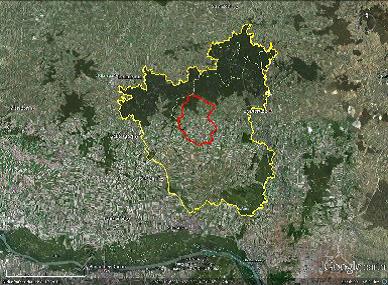
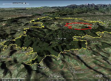
Elliptical area including Dürrenstein Wilderness Area, Gesäuse National Park and Kalkalpen National Park:
- Long axis (approx. W-E): 47° 11′ N, 13° 50′ E to 47° 58′ N, 16° 55′ E
- Short axis (approx. N-S): 47° 50′ N, 14° 27′ E to 47° 18′ N, 14° 52′ E
Alternative elliptical area additionally including Nockberge National Park (Carinthia):
- Long axis (approx. W-E): 46° 52′ N, 13° 35′ E to 47° 58′ N, 16° 55′ E
- Short axis (approx. N-S): 47° 50′ N, 14° 27′ E to 47° 18′ N, 14° 52′ E
Maps and plans,
showing boundaries of property and buffer zone
no information available
Area of property and buffer zone
Core area
Total 34,304 ha, as sum of:
- 20,850 ha (Kalkapen National Park),
- 11,054 ha (Gesäuse National Park), and
- 2,400 ha (Duerrenstein Wilderness Area)
Buffer zone
~ 19,000 km² (~ 100 × 60 km);
Alternative including Nockberge National Park: ~ 41,000 km² (~ 220 × 60 km)
Description
Description of the property
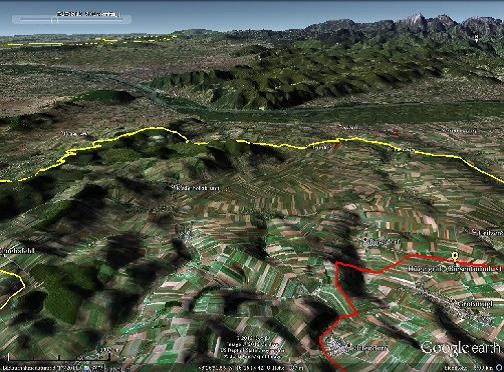
The iconic landscape of the alpine range and the moderate touristic development of its comparatively less known, very wide eastern third, form a ~1000 km² area containing natural skies above a unique mountain landscape.
The core-zone of the Eastern Alpine Starlight Reserve will be formed by combining three IUCN-recognised Austrian nature conservation areas, namely:
- The Wildnisgebiet Dürrenstein (Dürrenstein Wilderness Area) (IUCN I), of which the Urwald Rothwald (Rothwald primary forest) (IUCN Ia) is a component;
- The Nationalpark Kalkalpen (Kalkalpen National Park) (IUCN II); and
- The Nationalplark Gesäuse (Gesäuse National Park) (IUCN II).
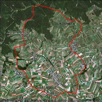
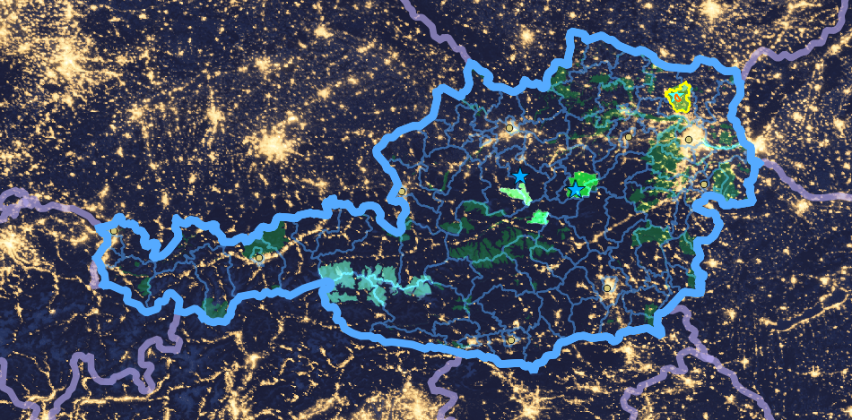
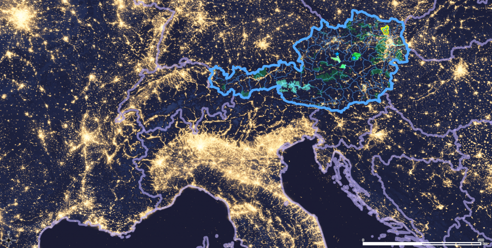
Together they span the “starlight triangle”, the core of the East-Alpine Starlight Reserve, that is readily visible as a central European dark spot on satellite imagery.
History and development
TO BE EDITED BELOW HERE
See remarks on the conservation areas that form the core zone and attached documents.
Justification for inscription
Comparative analysis
The sky-monitoring data (below) show an outstanding night sky quality comparable to the best astronomical sites of the planet.
For the alpine arc, the satellite data, cf. Figure 1 show that as far as light-sources on the ground are concerned the site is outstanding by the simple fact that it is the largest dark spot on the satellite maps in central Europe. That is not the complete story for sky quality as scattered light may play a role. Arguably scattering leads to a worsening of the conditions compared to what would be inferred from satellite images alone . The satellite data do only show the local sources of light not the effects of scattering that might occur from 100 or more kilometres away.
Along the alpine arc the Eastern Alpine location is optimum for minimising scattering effects on sky-quality as the light-intense regions of Northern Italy and the strongly developed western Alps are at maximum distance that can be achieved within the mountain-range.
On a European scale a comparative light-rejection effect would require a comparative height and width of a mountain range. Though 1000 m height reduces a large fraction of the aerosol-scattering, the skies certainly benefit from extra height. That is also true for the light-blocking effect where a mountain system acts like a natural stop for light or baffle. For that the width of the mountain range is important. That is a particularity of the Alps. It is shared with the Rocky Mountains, the Northern Andes and the Himalaya.
An additional factor is the absence of high-altitude plains that are attracting human settlement. In the Alps their absence reduces light pollution pressure compared to for example Salt Lake city in the Rocky Mountains.
Certainly a similar but narrower mountain-chain can protect skies of similar quality in less populated areas than Europe. Probably not entirely by chance the recognition of the exceptional sky quality of the Aoraki-Mackenzie-site occurred in the ’Southern Alps‘.
Alternatively, from the topographical point of view, IDA’s most iconic dark sky place, the Natural Bridges Dark Sky Park can be considered. It is located on the high altitude Colorado plateau that is sparsely populated. The ultimate limiting factor there would be the booming desert cities, as Salt Lake City and Las Vegas with growth uninhibited by the topography. Sample measurements by the author showed sky-quality that is indistinguishable within the natural variations to other top sites and the Eastern Alpine Starlight Reserve. But at this very high level of sky quality natural variations by the Milky Way, airglow and extinction variations due to seasonal variations mitigated e.g. by aerosols above the desert are major factors and require a significant body of measurements at both sites for a significant comparison.
In any case a comparison based on the sky-quality alone is insufficient due to the latitudinal variations of the night-sky - and the twilight. They are very significant and produce skies of different character, the common distinction between Northern and Southern sky just being the one of common knowledge.
Certainly a classification of sky-landscape systems will be necessary for a complete inventory of unique sky-heritage. In that respect a first step is to distinguish e.g. sky-landscape systems of high-altitude plains with their open skies, those with summit-gorge character as would be appropriate for canyon-lands, or others where parts of the horizon are formed by an ocean and the Alpine case of the firmament above the original Alpine aesthetic impression of a sea of mountains extending to the horizon. Once the value of the starry night-time view of landscapes under the Moon or in starshine will be more commonly appreciated it will become evident that the night-scapes are as rich and diverse as the landscapes and more specific comparisons will be possible.
Towards that goal the latitudinal aspect of the Alps (both northern and southern) is worth mentioning because together with the height it produces a relatively rare feature of icy or snowy summits year-round that create a particular impression when starlight or moonlight shines on white ground maximising contrast. That feature, in particular in Summer is lost by many mountain ranges - e.g. the middle Andes for the case of the famous Atacama observatory sites due to their location near the southern tropic.
A comparative analysis of the IUCN recognised natural values is beyond the scope of this extended case-study but necessary since the non-astronomical value may well be dominating.
Integrity and/or authenticity
See IUCN and other conservation documentation for the bio-aspects, samples in the attached remarks on the individual cores
Sky and night-light: see the monitoring section below
Sky and night-light: see ’Night-light and night-sky quality in the Eastern Alpine Starlight Reserve‘ below.
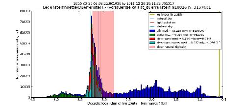
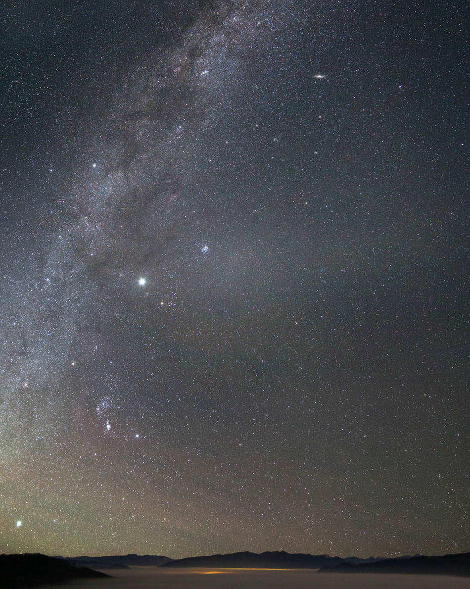
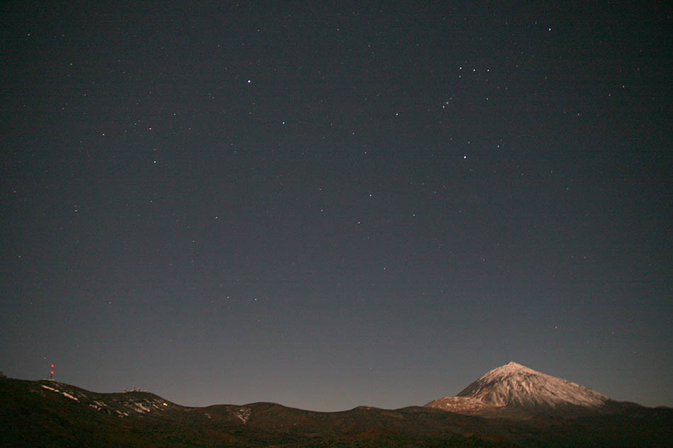
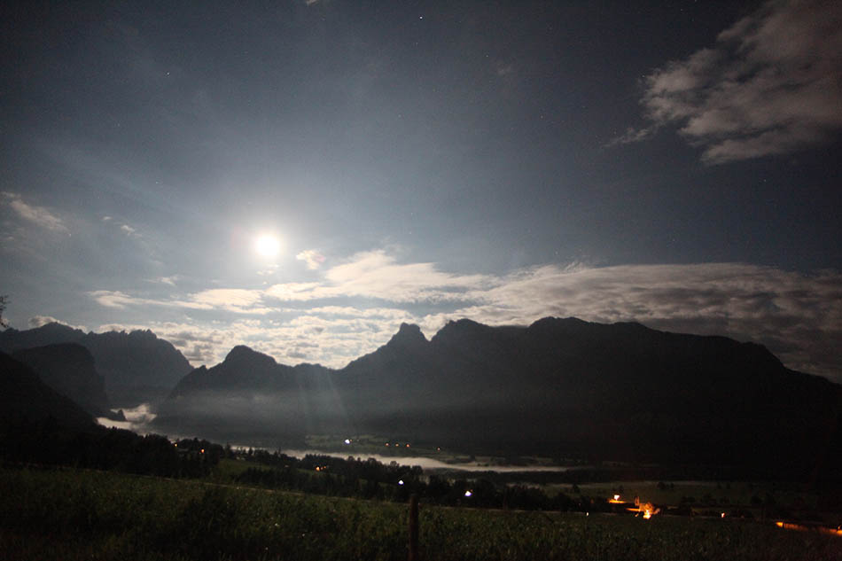
Night-light and night-sky quality in the Eastern Alpine Starlight Reserve
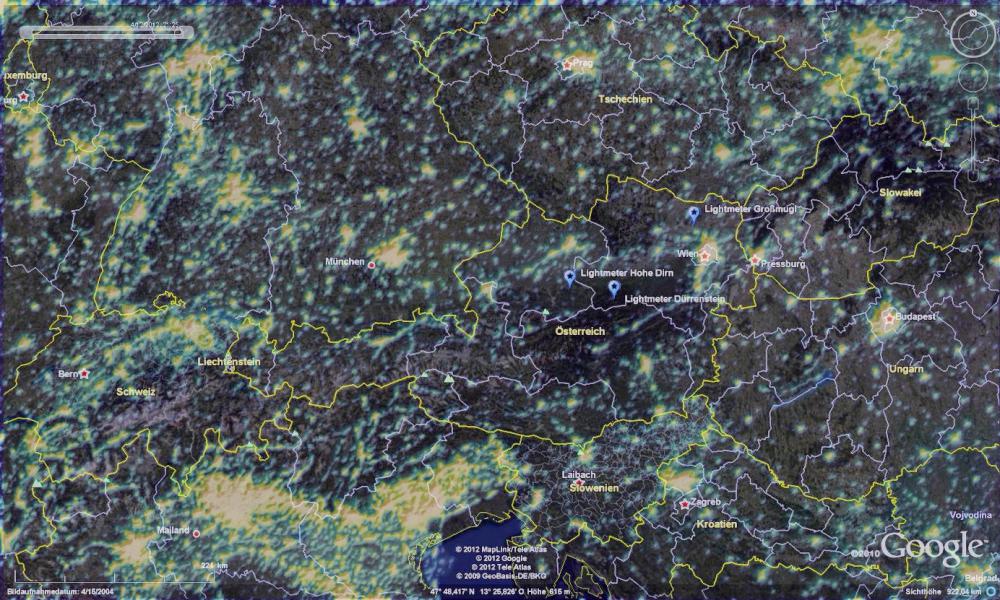
In 2001 the campaign ’How many stars can we still see?‘ (http://sternhell.at) showed that light pollution had significantly reduced stellar visibility in most parts of Austria but also pointed to near natural sightings by visual observers in some parts of Austria, hinting towards a sky quality even better than what would be extrapolated from satellite measurements. Though the satellite data also show a large dark spot in the eastern parts of the alpine arc, the sightings were surprisingly good, motivating further investigation.
Since the Year of Astronomy 2009, sky-quality in this area is charted and individual measurements were taken at some of the more difficult to access locations of the Eastern part of the Austrian Alps.
Continuous monitoring stations using a Lightmeter were established in the Dürrenstein Wilderness Area at 1500 m elevation (exact location of the lightmeter: 47°48’04’’ N, 15°02’34" E, 1475 m) and at the Hohe Dirn, at 1000 m elevation (exact position of the lightmeter: 47°54’20’’ N, 14°24’ 41’’ E, 1002 m), 15 km south of the Kalkalpen National Park. The Hohe Dirn station is located toward the north rim of the Eastern Alpine Starlight Reserve, the Dürrenstein-station to the northeast of the centre, where most of the development and light-pollution pressure can be expected as most of the Austrian population lives along the Danube to the North and East of the Alps.
The Lightmeter, (http://lightmeter.astronomy2009.at) is also used by the European Southern Observatory for professional site testing and as part of the monitoring during professional observations. Thus a direct intra-instrumental statistical comparison of the Alpine measurements to some of the best sites of the planet is possible.
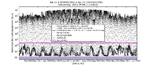
******* INSERT FIGURE 21HERE *******
Results for the Dürrenstein-site for 2010/11 are shown in Figure 21. Light levels are as for natural skies (cf. the comparison to the Atacama-Site at Cerro Armazones in the Großmugl comparative discussion section). The differences in the distributions are minor and can be attributed to the difference in weather patterns: there are actually darker situations in the Alps than in the Atacama desert due to the reduction of starlight and airglow by overcast. Light interaction with clouds and aerosols can lead to darkening (cloud absorption or extinction by aerosols) and brightening by scattered moonlight on certain types of clouds and residual light pollution, e.g. by scattering on high clouds above remote cities.The measurements in the Dürrenstein area include periods of high-altitude fog when a sea of clouds is formed around the central Alps that covers anything below 800-1000 m and thus a significant fraction of Europe - much like above cold ocean currents at the continental west-costs. The Alps under such conditions form mountain-islands in a sea of clouds that result in especially favourite sky conditions. An estimated 20% of measurements reflect such conditions.
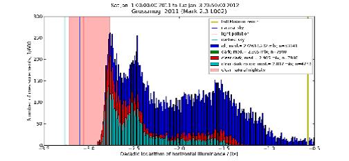
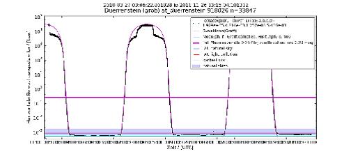
An example of the day/night run of illumination at the Dürrenstein site under those astronomically ideal conditions is shown in Figure 22. The entire range from full daylight at about 30 000 Lux to well below a mLux is shown. The relatively low daylight values and the long nights - short days are a consequence of the occurrence near the winter solstice. The measurements closely follow the theoretical day/night cycle and descend towards the reference ’darkest values measured‘ (cyan line).
******* INSERT FIGURE 22 HERE *******
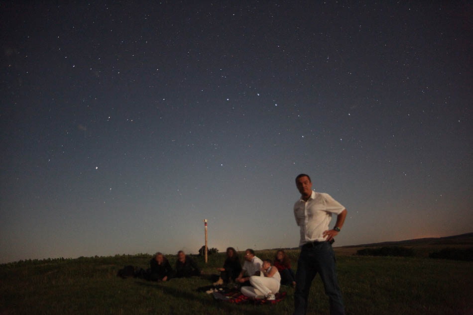
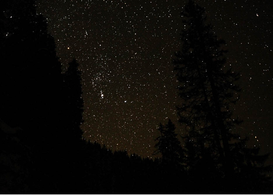
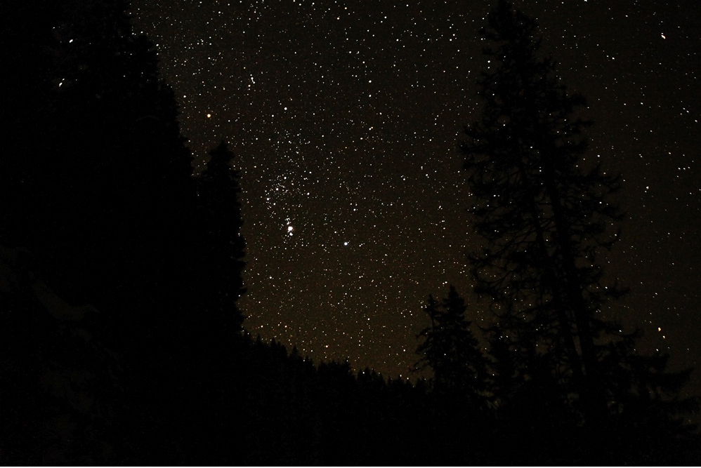
In summary a year of data from the Dürrenstein site demonstrates a robust occurrence of natural light levels - day and night in the Eastern Alpine Starlight Reserve, (see also the Gegenschein and the Zodiacal Band, imaged from the Hohe Dirn (near Steyr, upper Austria) at the northern rim as indicators off excellent sky quality in Figure XX). Conditions as under the darkest skies known are the most frequent and occur under prevailing weather conditions - not only under exceptional circumstances. The brightness of the sky is comparable to the one of the best astronomical sites of the world - of course not with the same number of clear nights.
******* INSERT FIGURE 23 HERE *******
Criteria under which inscription might be proposed
Dürrenstein Wilderness Area
Motto: Urwald und Urlicht – pristine sky above primary forest
Criteria under which inscription is proposed
Natural heritage OG (vii), (x)
From wildnisgebiet.at
Contains the largest contiguous stretch of primary forest in the Alpine-arc and is the treasure trove of Alpine Fauna and Flora supporting the original life-forms with its untouched soil and dead-wood.
„Wilderness Dürrenstein“, covering an area of nearly 1 235 acres, is characterized by the largest and vastest natural forests of Austria, which have not been cultivated or managed since the last ice age. As part of the Austrian Nature Conservancy Programme „Wilderness Dürrenstein“ therefore plays an important role in the protection of ecosystems and their endangered species in regard to sustainability.
Flora and Flauna
From wildnisgebiet.at
„Wilderness Dürrenstein“ is situated in the Southwest of Lower Austria, where it ranges from the border between Styria and Lower Austria up the flank of the „Dürrenstein“, with the mountain’s peak at an altitude of 1 878 m. Annual temperatures average 3,9 °C (39 °F) at an annual precipitation of 2 300 mm (90,6 inches).
Typical forests of this area - characteristic for the Alpine vegetation of the Northern Limestone Zone – are deciduous and coniferous forests, predominant species of trees being beech, spruce and fir. Due to diverse habitats within the area there is a differentiation between dense, moist forests with an undergrowth of foliage and sparse, dry slope forests with a grassy forest floor. On steep slopes and in deep ravines slope forests prevail, where deciduous trees like sycamore, ash and elm are predominant. There are only small patches of natural spruce forests within the area. They grow on rock debris and boulders along the tree line. Because of the humid climate with much snow in winter beech forests reach up to the tree line, too. Their understorey contains herbs like adenostyles (Adenostylus glabra), monkshood (Aconitum sp.), alpine dock or monk’s rhubarb (Rumex alpinus) and mountain ragwort (Senecio subalpinus).
At the tree line dense forests are substituted by mountain pines (Subalpine Zone), which merge into alpine grasslands and open fields around the Dürrenstein’s summit. Characteristic species of this zone are mountain aven (Dryas octopetala), silvery yarrow (Achillea clavennae), alpine calamint (Acinos alpinus) and alpine primrose (Primula auricula).
Within the forest region rock faces and boulders naturally lack trees; larger areas have been cleared for the cultivation of alpine pastures. These pastures are of great benefit for a nature reserve and are to be preserved.
Due to large amounts of rotting wood accumulating in natural forests, there is a wide variety of fungi, including species which are unique to the area and have been catalogued here. In all, more than 600 species of fungi grow in the area of „Wilderness Dürrenstein“.
The fauna of „Wilderness Dürrenstein“ includes almost all species typical for the Eastern Alps. Large predators like the brown bear and sometimes the lynx and herbivores like deer, chamois and (mountain) hare are endemic to the area. Smaller vertebrates present are the alpine newt and – salamander and the European adder. A large number of birds inhabit the area, especially woodpeckers and, very remarkably, all grouse species endemic to Austria, have settled here (wood -, black -, hazel grouse and ptarmigan). Even the golden eagle soars at the sky.
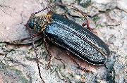
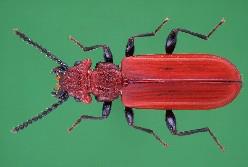
Decomposers and species living on and in rotting wood are numerous, represented by the longicorn beetle (Rosalia longicorn), an EU priority species.
Zoning
According to IUCN guidelines and for temporal and spatial differentiation of planned and possible measures, "Wilderness Dürrenstein" is divided into different zones. Zoning is based on results of a survey of the status, of development capabilities, of necessary measures and planned types of land-use. Consequently "Wilderness Dürrenstein" comprises the following zones:
Natural zone:
Within the "natural zone" no measures are implemented (exception: game regulation). Visitors may enter certain parts of this zone when participating in guided tours. Approximately 85 % of the area of "Wilderness Dürrenstein" are part of the zone.
Natural zone with silvicultural management:
For a limited period of time, secondary spruce forests are transformed into mixed forests with a high amount of deciduous trees by silvicultural management. Less than 5 % of the total area of "Wilderness Dürrenstein" have to be attended.
Management zone of alpine pastures:
For reasons of nature conservation cattle grazing is carried out/allowed here to the same extent as previously. Alpine pastures are habitats for a large number of rare species of plants and insects, as well as for black grouse and ptarmigan. Appropriately, the management zone "limestone grassland" serves the same purpose. About 10 % of the area of "Wilderness Dürrenstein" are under significant anthropogenic influence.
Wildlife management zone:
Large predators like brown bear, lynx or golden eagle appear only occasionally in the area. To safeguard the natural, interdependent ratio of trees and game, the number of ungulates (red deer, roe deer and chamois) has to be regulated according to ecological points of view. For this reason there is a "wildlife management zone", which comprises 25 % of the total area of "Wilderness Dürrenstein".
Kalkalpen National Park
Mountain Forest – Mountain skies
Criteria under which inscription is proposed
Natural heritage OG (vii), (x); Cultural-landscape OG (v) alm-management
Data and information from www.kalkalpen.at:
Reichraminger Hintergebirgeis part of one of the most unspoilt wooded areas in Austria. So far it has not been affected and destroyed by public transportation routes or settlements.
You will become an eyewitness by observing the intact and unbroken system of streams containing water of high quality.
Sengsengebirgeis known as the northern entrance to the alpine Kalkalpen. The mountain range itself reaches a length of 20 km and its highest peak is the Hohe Nock (1,963 m). The name “Sengsengebirge” is derived from the former use of the springs as an energy source for manufacturing scythes. This was carried out by traditional blacksmiths.
Characteristic features:
Opened: 25th of July 1997
Size: 20,850 ha
Zone: 89% natural, 11% managed
Ownership: 88% state, 11% private, 1% local community
International recognition: IUCN category II, Ramsar site and Natura 2000
Elevation: 385 to 1,963 m (Hohe Nock)
Main rocks: limestone, dolomite.
81% Forest
8% Mountain pine
6% Alpine pastures and meadows
5% Rocks and rubble
See also a comparative listing of biodiversity in the Kalkalpen National Park, attachment KNP_01.
Gesäuse National Park
Criteria under which inscription is proposed
Natural heritage OG (vii), (x), (viii); Cultural-landscape OG (v) alm-management
Ragged limestone mountain-massive and canon of the Enns-river in Alpine Starlight. Milky way on canyon sky and panoramic central Alpine night-scape outlook.
Informations from the national park (nationalpark.at):
The Nationalpark Gesäuse was the sixth Austrian national park to be established and is the third largest. It is located in the area of the Ennstal Alps/Gesaeuse and, broadly speaking, embraces two massifs: the Buchsteinmassiv and the Hochtorgruppe.
Total area of the National park: 11,054 hectares
Natural Zone: 86 %
Protected Zone: 14 %
Foundation: 26th October 2002
Sea level: 490 m to 2,370 m (altitude difference 1880 m)
Highest elevation: Hochtor 2,370 mGeology: Northern Limestone Alps, most common types of rocks: Dachstein limestone, Ramsau dolomite.
Natural Area: Alpine areas 31%
Scrub-land 13.5%
Woodland 50%
Open water 0.5%
High pasture, meadow 5%
Ownership (by proportion):
99.3% Land Steiermark - Styria
(Stmk Landesforste - Styrian Provincial forestry Commission)
0.5% open-access stretches of water
0.2% private landowners
National Park municipalities:
Johnsbach 51%
Weng 30%
Admont 7%
Landl 6.5%
Hieflau 4.5%
St.Gallen 1 %
Adjacent and Overlapping Protected Areas: Eisenwurzen Nature Park 9% within the National Park boundaries
Natura 2000 Flaeche: 94% within the National Park boundaries
Suggested statement of OUV
The Dürrenstein Wildernis area with its last remaining stretch of Alpine primary forest contains the ultimate in-situ conservation area for numerous species supported by and depending on the original soil and dead-wood organisms with fungii and micro-flora and fauna as the only still existing support for other unique species OG (x) - contain the most important and significant natural habitats for in-situ conservation of biological diversity, including those containing threatened species of Outstanding Universal Value from the point of view of science or conservation. The larger species form a prototypic “Urwald”, with a unique day and night-time beauty where the “primary” sky naturally blends in with the ragged mountain scenery offering nocturnal phenomena of utmost aesthetic importance, OG (vii) - contain superlative natural phenomena or areas of exceptional natural beauty and aesthetic importance, Operational guidelines for the implementation of the World Heritage Convention, WHC. 11/01 November 2011. In addition to analogous conservation of important species, the Gesäuse and Kalkalpen national parks protect the Alp-managment - the human land use that is name-giving for the entire “Alp” mountain range, the high-altitude agriculture management supporting human life and other species that adapted to it over the millennia. Sustaining human habitability in this extreme environment enabled a wide range of cultural activities since the Bronze-age, OG (v).
State of conservation and factors affecting the property
Present state of conservation
Natural skies above unique alpine habitats and mountain-landscapes protecting biodiversity.
Primary skies above the most pristine parts of the alpine sea of mountains sustaining biodiversity by providing habitats with natural day and night-time conditions to support the nocturnal majority and numerous daytime-active rare species and their habitats together with a landscape and nightscape of exceptional natural beauty and nocturnal phenomena of outstanding aesthetic importance.
See IUCN and other conservation documentation for the bio-aspects samples in the attached remarks on the individual site.
Factors affecting the property
Developmental pressures
The population of the area is shrinking and skiing activities in the neighbouring regions are reduced and will reduce further with climate change.
[fragmentation by urban development is not an issue in this area as it experiences population decrease].
Environmental pressures
A possible light-spill by increase of light-pollution from remote (> 100 km) city growth that will be partly or completely counteracted by the spread of national light-pollution laws (already existing in the Czech-republic, Slovenia and many provinces of Italy).
Natural disasters and risk preparedness
--
Visitor/tourism pressures
Skiing and other alpine outdoor activities.
Number of inhabitants
None in the 3 IUCN-recognised areas, an estimated 100 000 in the buffer-zone.
Protection and management
Ownership
Mixed ownership with a large fraction of state owned land through the Austrian federal forest administration (Bundesforste), see comments on the core-zone components for a break-up of the respective ownership.
Protective designation
Natural heritage; Starlight Natural Site in the context of the Starlight Reserve Document.
Means of implementing protective measures
In act: federal national park law and state nature protection law. An IUCN-recognised body of nature-protection regulations for the conservation zone of the three components of the core zone, see the remarks.
It is worth mentioning that e.g. in the conservation-zone of the primary forest of the Dürrenstein Wilderness area any human access is only possible under exceptional circumstances.
In preparation: state light pollution laws with sections on conservation areas.
Existing plans
Increase of the existing night-oriented activities managed by the park-administrations in cooperation with astronomical organisations, e.g. Kuffner-Sternwarte.at, Sternfreunde Steyr, http://www.sternfreunde-steyr.at/
Property management plan
See the remarks on the cores and related material.
Sources and levels of finance
See the three ’core‘-institutions - 2 national parks and the wilderness area management.
Sources of expertise and training
National Park infrastructure; University of Vienna (Intitute for Astronomy) including didactics of astronomy education for teachers, Kuffner-Sternwarte society (amateur, professional astronomers and physicist from various disciplines), Linzer Astronomische Gemeinschaft, Sternfreunde Steyr, Hochbärneck Observatory.
National park institutions.
Visitor facilities and infrastructure
National Park and Wilderness Area visitor centres and infrastructure.
Presentation and promotion policies
Following the National Park and Wilderness Area that already included the night-activities in their programming.
Staffing levels and expertise
Sum of full-time staff of core-zone institutions, estimated 100.
Monitoring
Indicators for measuring state of conservation
Illumination levels and total radiation.
Complementary background sky brightness or near zenithal average sky brightness (SQM-measurements) and all-sky imaging.
Air quality related value as visibility versus haze:
├ö├çó total aerosol optical depth
├ö├çó aerosol (cumulative number below size) ppb in mass (pm 2.5, pm 10 - mass fraction of particulate matter (pm) with respect to upper limit in size specified by ┬Ám)
├ö├çó ozone (health)
Natural values: according to the IUCN protected area categories; other frameworks, see remarks about core zones.
Administrative arrangements
See the 3 park administrations.
Continuous monitoring carried out by the Kuffner-society in collaboration with the Dürrenstein Wilderness area and the Sternfreunde Steyr.
Results of previous reporting exercises
See IUCN, Natura 2000 and Ramsar documentation, note the area-breakup of protection schemes in the section with specific remarks about the core-components.
Documentation
Photos and other AV materials
Rich multilingual documentation at
http://wildnisgebiet.at/ (Dürrenstein Wilderness Area)
http://www.nationalpark.co.at/ (Gesäuse National Park)
http://www.kalkalpen.at/ (Kalkalpen National Park)
Texts relating to protective designation
See remarks to the three core-components.
Most recent records or inventory
See below, at the specific remarks for core components for an overview, the complete documentation on biodiversity etc is hold and maintained under IUCN-regulations.
Agencies holding inventory records
Dürrenstein Wilderness Area
Gesäuse National Park
Kalkalpen National Park
Kuffner-Sternwarte society for light-mapping
Bibliography
Extensive bibliography see the park websites, examples on biodiversity and sample species including the respective biography are attached.


No multimedia content published
Currently there is no multimedia content published for this case study