Category of Astronomical Heritage: tangible immovable
Dengfeng observatory, China

Presentation
Geographical position
The observatory lies to the north of Gaocheng Town, 12 km south-east of Dengfeng City, Henan Province, China.
Location
Latitude 34° 27′ 31.5″ N, longitude 113° 04′ 03.8″ E. Elevation 380m above mean sea level.
General description
Dengfeng Observatory forms part of the property Historic Monuments of Dengfeng in ‘The Centre of Heaven and Earth’, which was inscribed on the World Heritage List in July 2010 under categories (iii) and (vi). This includes the ancient architectural complex at Mount Song and the site of the Xia-dynasty capital. They are situated in and around Mount Songshan in Henan Province in China. The complex consists of the following 13 ancient structures and sites: Taishi, Shaoshi and Qimu Towers; the pagodas of Songyue and the pagoda of Master Jingzang; the Observatory itself; the Chuzu Temple; the pagoda forest of Shaolin Monastery; the Huishan Temple and the Songyang Academy; the Zhongyue Temple; the Shaolin Monastery; and the site of the Xia-dynasty capital at Wangchenggang. A great many different attributes of cultural value merge together inside the Mount Song site.
The site is 37m wide from east to west and 150m long from north to south, covering 5550 m². Two astronomical monuments remain at this spot: an observatory of the Yuan Dynasty (1279-1368) and a stele of the Tang Dynasty (618-960). The main feature of the Yuan Dynasty Observatory is a device for measuring the length of the sun’s shadow at noon and tracing its variation through the year. It functioned by casting the shadow of a horizontal bar down onto a large horizontal scale extending to the north. This innovative design effectively created a gnomon five times the height of the standard gnomon used for the same purpose through Chinese history.
The earlier stele marked this place as a key node in a remarkable 8th-century geodetic survey that established the length of a degree of the meridian.
Brief inventory
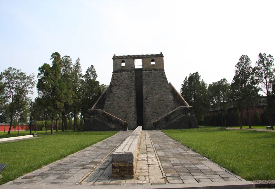
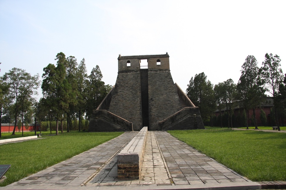
The main structures forming the observatory are a brick-built platform in the shape of truncated pyramid and a horizontal scale extending to the north.

Fig. 1. The Yuan Dynasty Observatory. Photograph © Xu Fengxian
The platform is 9.45m high and its sides are over 16m long at the base and over 8m long at the top. On the northern part of the platform stand two rooms separated by an opening. Each of the two rooms has one window facing the other room and a second window facing north. The two rooms and the opening are covered by an elongated roof, which is 12.62m above ground level. A horizontal rod connects the two rooms through their facing windows, and directly below this a groove with vertical sides runs down the centre of the north side of the platform. Two stairways lead up to the platform from the bottom of the north side, one running up the east side and one up the west side. The stairways and the platform are contained within low walls 1.05 m in height.
The scale, which is called the sky-measuring scale, was built using 36 stone blocks. It measures 31.19m in length and runs due north-south, its south end continuing into the groove on the north side of the platform. Two parallel troughs run along the top of the scale; they are linked at the ends and would have held water to form a level surface. According to historical records, the length of the sky-measuring scale was 128 chi, the chi being one of the basic Chinese units of length; the height from the surface of the scale to that of the bar between the two rooms on the platform, 9.75m, was exactly 40 chi.
On either side of the scale at its north end are two reconstructed astronomical instruments that were originally invented by Guo Shoujing. On the eastern side is the zheng fang an, or ‘square meter’, while to the west is the yang yi, a type of sundial using a spherical surface.
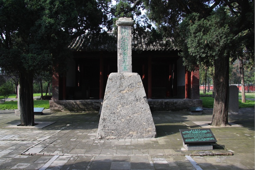
The Tang Dynasty stele lies to the south of the Yuan Dynasty observatory. It consists of a stone gnomon mounted truncated stone base, both the gnomon and the base being 1.98m in height, exactly 8 chi according to the metrology in use during the Tang Dynasty. The base is nearly rectangular in cross-section at the bottom (1.8-1.9m from east to west by 1.70m from north to south), and nearly square at the top (width 0.88-0.89m). The gnomon consists of a 1.64 m-high standing stone and a 0.34 m-high cap. The stele is so arranged that the sun at noon on the summer solstice casts no shadow beyond its heavy truncated pyramidal base.
Between the Yuan Dynasty observatory and the Tang Dynasty stele is the later Zhou Gong’s Temple, built during the Ming Dynasty.

Fig. 2. The Tang Dynasty stele. Photograph © Xu Fengxian
History
Gaocheng occupies a special place in Chinese history as well as in the history of Chinese astronomy (for which, see below). Before the Tang Dynasty its name was Yangcheng, and according to classical Chinese texts, Emperor Yu the Great, founder of the Xia Dynasty, the first Dynasty in Chinese history, made Yangcheng his capital in the 21st century BC.
The Tang Dynasty stele was erected in AD 723 by Nangong Yue, a Tang Dynasty astronomer who responsible for the survey of four sites in Henan as part of Yixing’s geodetic survey (see below).
The Yuan Dynasty observatory was originally built in 1279 by Guo Shoujing (1231-1316). It was repaired in 1542 during the Ming Dynasty (1368-1644). Zhou Gong’s Temple was also built in the Ming Dynasty, in commemoration of Zhou Gong, who is believed to have carried the earliest measurement of the sun’s shadow in Yangcheng.
Cultural and symbolic dimension
Ever since ancient times, Chinese people had believed that the world has a centre. According to the ancient text Zhou li, the founders of the Zhou Dynasty in the mid 11th century BC used a gnomon to determine the site of their capital. Observations of the lengths of the sun’s shadow were used to determine the latitude in order to fix provincial and other territorial boundaries, but only the place where an 8-chi-long gnomon cast a 1.5-chi-long shadow at noon on the summer solstice was the centre of the world. By at least the 1st century BC, astronomical authors were identifying this place with Yangcheng, i.e., today’s Gaocheng. From then on, astronomers considered Yangcheng the best place for astronomical observations, and especially for measuring the length of the sun’s shadow. Since the summer and winter solstices, and hence the length of the tropical year, were determined in this way, traditional Chinese calendars paid special attention to the sun’s shadow. Generations of astronomers measured the sun’s shadows at Yangcheng, or used the results from Yangcheng, to make calendars.
Before about the 5th century AD, Chinese astronomers believed that the sun’s noontime shadow length on any given day of the year increased in proportion to the distance north of the earth’s centre at Yangcheng, and decreased similarly in proportion to the distance south. This is not actually true because of the curvature of the earth’s surface. A number of experiments during the 5th and 6th centuries disproved this idea and between AD 721 and 725 Yixing, a Tang Dynasty monk, organised a geodetic survey using thirteen stations running from latitude 52° in the north down to latitude 17.4° in the south, including Yangcheng, which was regarded as the standard against which all the other data were compared. This is perhaps the most remarkable piece of organized field research carried out anywhere in the early Middle Ages. Yixing obtained a complete set of values for the altitude of the celestial north pole and the length of the sun’s shadow at noon on the two solstices and the equinoxes, and concluded that the altitude of the north pole changes in proportion to the distance along the meridian, thereby determining the length of a degree of the meridian.
Measuring the sun’s noontime shadow was the main method used in China to determine the seasons and calculate the length of a tropical year. Traditionally the gnomon was 8 chi long, which meant that the length of the gnomon was close to a person’s height. At the start of the Yuan Dynasty, the astronomer Guo Shoujing was asked to make a new calendar. He designed many new astronomical instruments and organized a large-scale survey. Gou Shoujing found that the taller the gnomon, the more precise the results of the measurements, and the 40-chi-long gnomon is one of his most important innovations. The instrument at Dengfeng was one of two built by Guo, the other being in Dadu (today’s Beijing). Guo’s Shoushi Calendar was not only used until the end of the Yuan Dynasty; it continued to be used, with only a small adjustment, throughout the Ming Dynasty.
Management and use
Present use
The site belongs to Dengfeng Municipal Bureau of Culture Relics and is open to the public as a historical monument.
State of conservation
The site is generally in a good state of preservation and management. Most of the bricks used in building the platform are in good condition.
Protection
In 1961, Dengfeng Observatory was included among the first group of the nation’s key sites needing protection to be identified by the State Council of China.
Context and environment
Mount Song lies to the north, the Ji hill lies to the south, and the Ying River runs past on the south side, flowing from north-west to south-east.
Management, interpretation and outreach
This will be developed inside the future management plan for the ‘Historic Monuments of Mount Song’.
No multimedia content published
Currently there is no multimedia content published for this case study


